")


Zadnjica Valley
A semi-demanding biking tour leads to the end of Zadnjica Valley.

Details
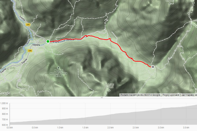
- Route: Trenta - Zadnjica Valley -Trenta
- Trail: semi/very demanding
- Suitable for: mountain and road bikes
- Length: 7.5 km
- Altitude difference: 330 m
- Download GPS Garmin: zadnjica.gdb
- Download GPS XML: zadnjica.gpx
Route description
The starting point is at the Vršič Pass sepentine No.50, not far from the settlement called Na Logu in the Trenta Valley. It continues via macadam road following the right bank of the Krajcarica Stream. After some kilometres, the road branches off more noticeably. To the left leads a mountain trail to Kriški podi (Križ Plateau) and up to the Belopotoški slap (Beli Potok Waterfall), while you must go straight toward the end of the valley, where the gently-sloping road narrows and becomes steeper. The trail ends under the mighty wall of Kanjavec, which is the starting point for climbing Mt. Triglav via Dolič as well as for visiting the Sedmera jezera (Seven Lakes of Triglav) via Prehodavci.
Points of interest
A magnificent wall of Kanjavec at the end of Zadnjica Valley.
Map and elevation profile