")
Vrsnik
A semi/very demanding biking trail that leads to the mighty walls of Veliko Špičje.
Highlihts
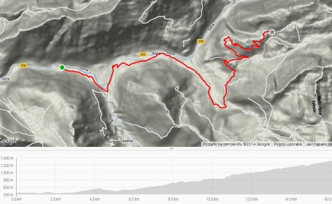
- Route: Soča - Campsite Klin - Vrsnik - Hunter hut - Vrsnik - Campsite Klin - Soča
- Trail: semi/very demanding
- Siutable for: mountain bikes
- Length: 32.4 km
- Cumulative altitude: 1020 m
- Download GPS Garmin: vrsnik.gdb
- Download GPS XML: vrsnik.gpx
Route description
The tour starts at the wooden footbridge across the Soča River located approximately 7 km from Bovec in the direction of Trenta. After crossing the river via the footbridge, turn left and follow the cart track, which leads along the left bank of the Soča River to its confluence with the Lepenjica Stream. Soon after the confluence, continue to the bridge over the Lepenjica Stream. After the bridge, turn left to the asphalt road and go straight, passing the Klin camp, to the bridge across the Soča River. Before the bridge, turn right to the ascent and follow the macadam road straight along the left bank of the Soča River to the intersection with an asphalt road. Here, turn right toward the hamlet of Vrsnik. After 3 km, the asphalt road turns into macadam again and ascends to the hamlet called Na skali. Continue through the hamlet and uphill to the hunters' hut (1320 m ). Return is made via the same route.
Points of interest
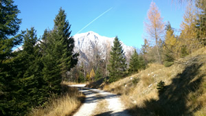
The last part of this tour offers an extraordinary view of Vrsnik. Those who are more ambitious can combine this biking experience with hiking: a climb to Čisti vrh (1875 m ), rising above Trenta, which is well known for its splendid views.
Map and elevation profile